
UAV Weather Stations: Correcting Rotor Downwash and Measuring 3D Atmospheric Boundary Layer Wind Vectors
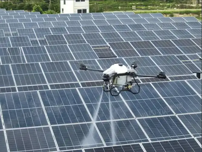
Unmanned Aerial Vehicles (UAVs) have revolutionized atmospheric boundary layer (ABL) research, wildfire boundary tracking, and industrial chemical plume dispersion monitoring. Compared to tethered meteorological balloons or static flux towers, a multi-rotor drone offers spatial agility and automated vertical profiling up to several hundred meters.
However, mounting precision meteorological instruments to a multi-rotor UAV introduces a major aerodynamic challenge: rotor propwash and induced turbulence. A drone hovering or ascending generates violent downward and outward velocity fields that completely corrupt ambient thermodynamic and kinematic measurements. Discover how lightweight, low-drag sensors solve these challenges within our mobile and UAV meteorological solutions.
1. Aerodynamics of Rotor Downwash and Sensor Placement
Multi-rotor propulsion relies on accelerating large air masses downward to generate thrust ($T = dot{m} v_i$). The resulting induced flow field creates three distinct operational zones around the airframe:
- The Ingestion Zone (Above Rotors): As air is drawn into the spinning propeller blades, streamtube contraction accelerates air velocity vertically downward toward the blade discs.
- The Downwash Jet (Below Rotors): High-velocity turbulent propwash vortices shear downward, generating massive dynamic pressure spikes, thermodynamic frictional heating, and acoustic noise.
- The Free-Stream Far Field: The undisturbed ambient atmosphere beyond the drone's aerodynamic envelope.
Mounting a sensor beneath the fuselage places it directly inside the downwash plume. To capture genuine free-stream ambient wind velocity and direction, the sensor must be positioned on a rigid, forward-canted mast extending at least 1.5 to 2.5 times the rotor radius ($R$) above the plane of the upper propeller discs, or forward of the airframe along the flight velocity vector.
2. Vector Subtraction: Resolving True Ambient Wind ($ ec{V}_{true}$)
Even with optimal boom placement outside the core downwash streamtube, an airborne sensor measures the apparent relative wind vector ($ ec{V}_{apparent}$), which is contaminated by the drone's ground velocity and rotational attitude. The genuine 3D ambient wind vector is calculated via coordinate frame transformations:
$$ ec{V}_{true} = mathbf{R}_{b}^{n}(phi, heta, psi) left( ec{V}_{apparent_body} + ec{omega}_{body} imes ec{r}_{lever} ight) - ec{V}_{UAV_ground}$$
Where:
- $mathbf{R}_{b}^{n}(phi, heta, psi)$: Direct cosine rotation matrix transforming body-frame coordinates (roll $phi$, pitch $ heta$, yaw $psi$) into the Earth-fixed North-East-Down (NED) navigation frame via fused high-rate IMU and GNSS telemetry.
- $ ec{V}_{apparent_body}$: 3D wind velocity vector captured by the acoustic sonic transducers.
- $ ec{omega}_{body} imes ec{r}_{lever}$: Angular velocity cross-product correcting for lever-arm motion between the drone's center of mass and the offset sensor boom tip.
- $ ec{V}_{UAV_ground}$: Real-time ground speed vector derived from dual-antenna RTK GNSS receivers.
3. Size, Weight, and Power (SWaP) Engineering
Standard meteorological anemometers built from die-cast aluminum weigh between 800g and 2.5kg—far too heavy for commercial UAV payloads where every 100 grams reduces flight endurance by 3 to 5 minutes. Field-grade drone payloads like the VT-WDC2E Ultrasonic Anemometer utilize aerospace-grade carbon fiber shafts and structural ABS sound heads, keeping total payload mass under 120 grams while drawing less than 0.2W of power from onboard 5V/12V drone avionics rails.
4. Field Applications: Wildfire Spread and Gas Plume Tracing
High-rate airborne acoustic sensing unlocks critical mission profiles:
- Prescribed Burn & Wildfire Dynamics: UAVs loitering ahead of flame fronts measure sudden wind shifts, localized thermal updrafts, and relative humidity depressions, providing incident commanders with immediate fire spread vectors.
- Hazardous Gas Flare Plumes: Pairing ultrasonic 3D wind detection with miniature electrochemical or NDIR gas sniffers allows algorithms to track volatile organic compound (VOC) concentration gradients back to industrial pipeline leak sources.
Conclusion
Achieving scientific-grade boundary layer wind measurements from unmanned aerial systems requires the convergence of aerodynamic boom positioning, sub-gram SWaP-optimized acoustic sensors, and millisecond vector transformations. Consult with our engineering team to integrate custom airborne sensor arrays into your commercial UAV payloads.